We developed our mobile tide chart software because we felt there was nothing for us to personally use when fishing, surfing or boating. We needed the ability to view tide stations while on the water combined with tidal flow and displayed on a satellite map to view potential fishing grounds. This personally allowed us to extend our fishing trips by following the natural tide movements and water flow throughout the day without any guesswork. The satellite view has been critical in discovering new fishing area opportunities even if you are local to an area. It’s amazing what a satellite catches from above that you might have missed your whole life.
Chose your mobile device:
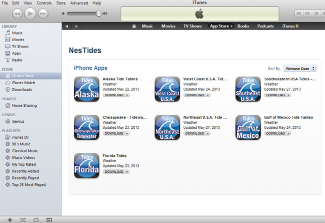
Apple Tide Apps
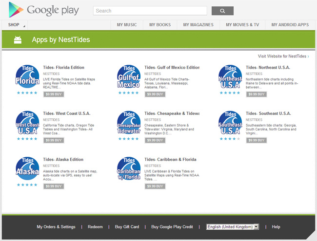
The Android Tide App the Pro’s Use
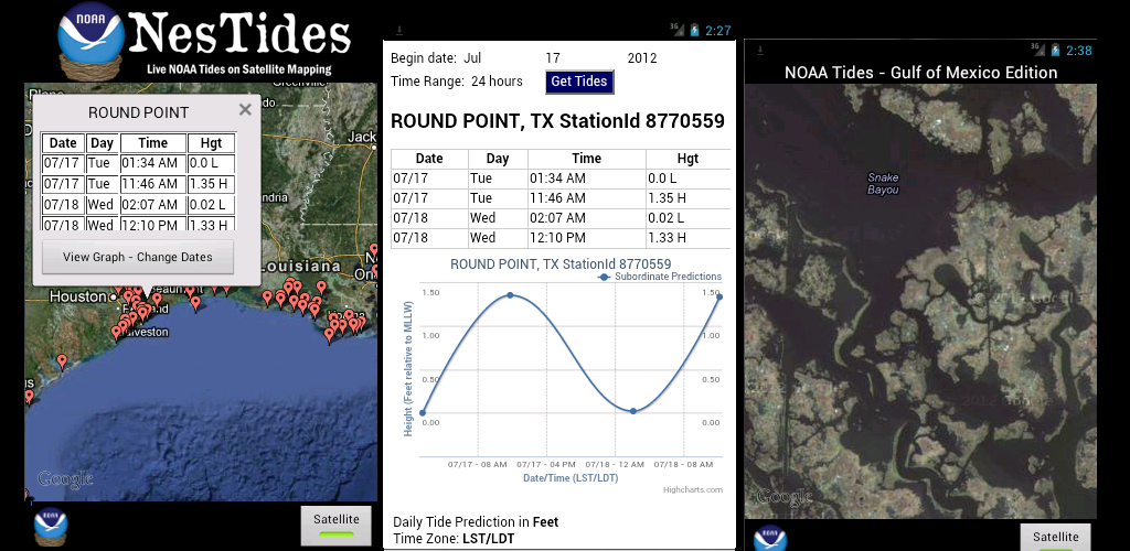
A tide station directly from NOAA on every coast in the U.S.A.